Canada Maps Home > Canada Map Collection > Southern British Columbia Map
Printable Map of Southern British Columbia
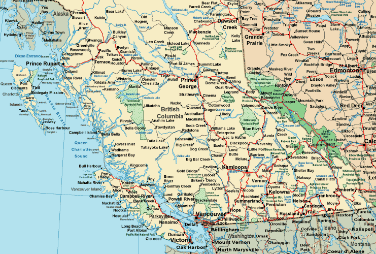
The above map image is a basic figure that sports the geography of this locality with a simple combination of details.
You have permission to use this web page and utilize it in your research. Linking back to this resource is our request.
In case you are looking for aid finding a map, a distinct kind of map, or are looking for a good custom-built cartographic design, just contact YellowMaps.
Acquire proper custom-built maps from us. Our custom-made maps embrace a wide variety of map components, like: roads, legend, UTM coordinates, beaches, military area, unincorporated areas, cliffs, or rapids, etc. Types of maps run from economic geography to tourism, travel to research, census tracts to planning regions.
Good maps are clear, all-encompassing, and not old. First-Rate map design by YellowMaps.
To buy physical maps, e.g. wall maps, country maps, or maps for canoeing, I suggest you dive into our map store We hold tens of thousands products.
Cartography is so much fun. Just sit back in your chair and travel states, provinces, and countries, and never even move a leg. Who doesn't like that?
Back to Canada map collection