Canada Maps Home > Canada Map Collection > Alberta Map
Printable Map of Alberta
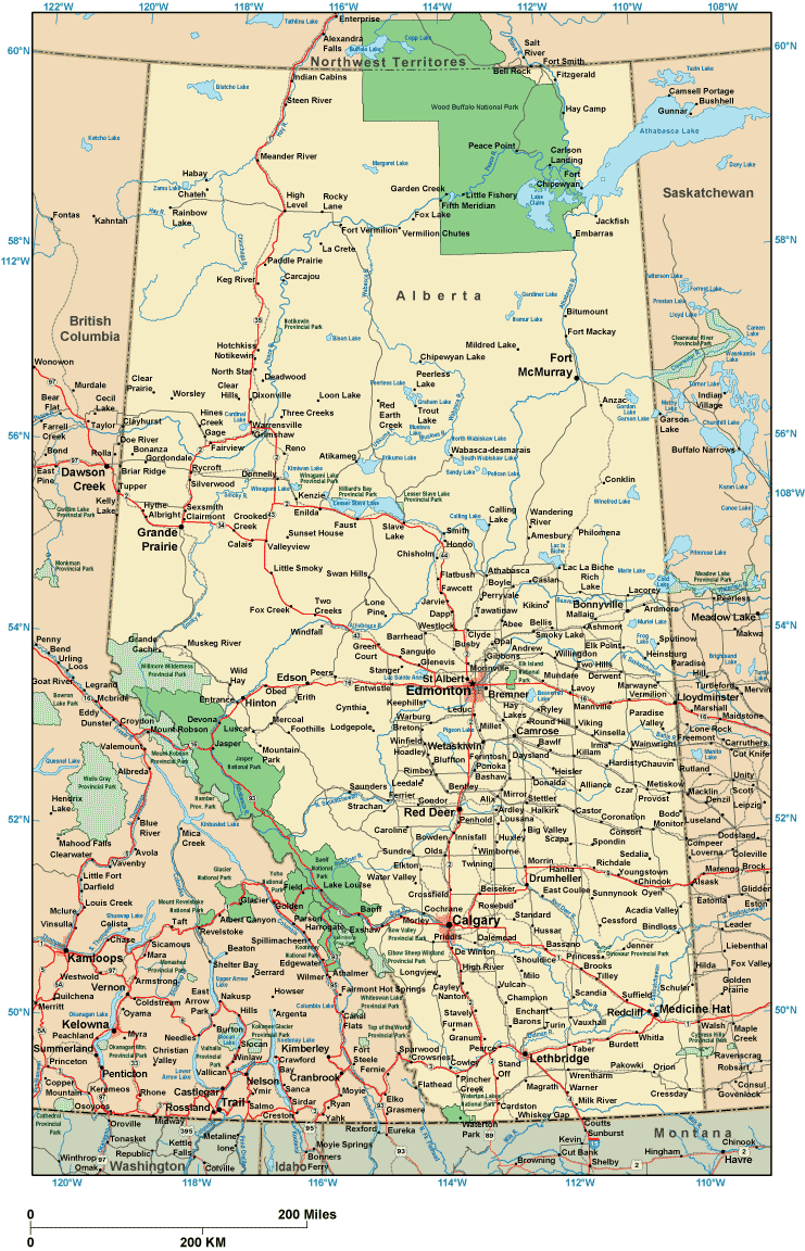
On top we have a classic sketch displaying the locations of this region with a basic diversity of features.
You are allowed to share the map image and employ it in your projects. Linking back to this resource would be helpful.
In case you call for help obtaining a map, a particular map, or call for a great customized map, you can contact us.
Purchase great customized maps from us. Custom maps made by YellowMaps cover a useful array of elements, like: backroads, elevation information, coordinates, district municipalities, military area, territories, forests, or river features, etc. Types of custom maps range from economic geography to satellite, static to dynamic, counties to ZIP code tabulation areas.
Great maps are accurate, all-encompassing, and not deceptive. Fine map production by YellowMaps.
To buy printed maps or charts, such as navigational charts, world maps, or topo maps, do not hesitate to browse our online map store We hold tens of thousands map items.
Have trouble printing or downloading this map? Just contact us.
Back to Canada map collection