Canada Maps Home > Canada Map Collection > Map of Northwest Territories
Printable Map of Northwest Territories
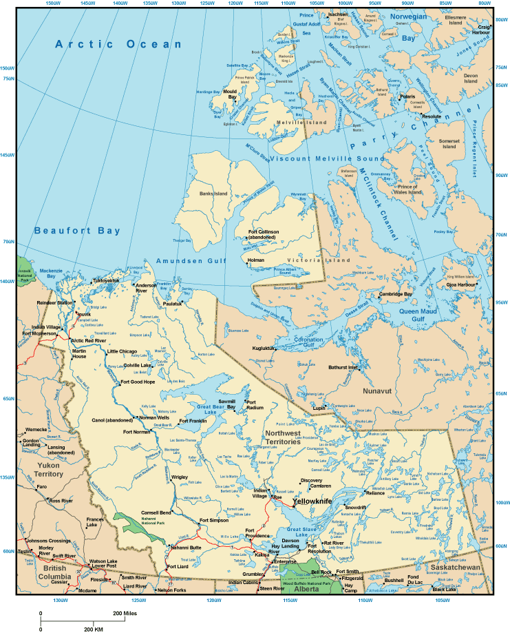
The image above is a basic picture laying out the layout of this neck of the woods with a basic array of features.
You are granted permission to store the map and make use of it for a variety of purposes. Providing a link to here is always appreciated. Thank you kindly.
In case you need assistance locating a map, a different kind of map, or need a suitable custom-made product, please do not hesitate to contact YellowMaps.
Buy good personalized maps from us. Custom maps made by YellowMaps have a wonderful variety of map elements, like: avenues, scale bar, UTM coordinates, bays, major municipal/district areas, shoals, falls, or recreational sites, etc. Map types range from trail to satellite, printed to electronic, national to places.
Suitable maps are exact, up to date, and not unclear. Fine map production by YellowMaps.
To acquire printed maps or charts, for instance wall maps, tourist maps, or topographic maps, quickly dive into our map store We hold over 100,000 products.
Have trouble printing or downloading this map? Just contact us.
Back to Canada map collection