Canada Maps Home > Canada Map Collection > Canada Land Cover Map
Printable Map of Canada Land Cover
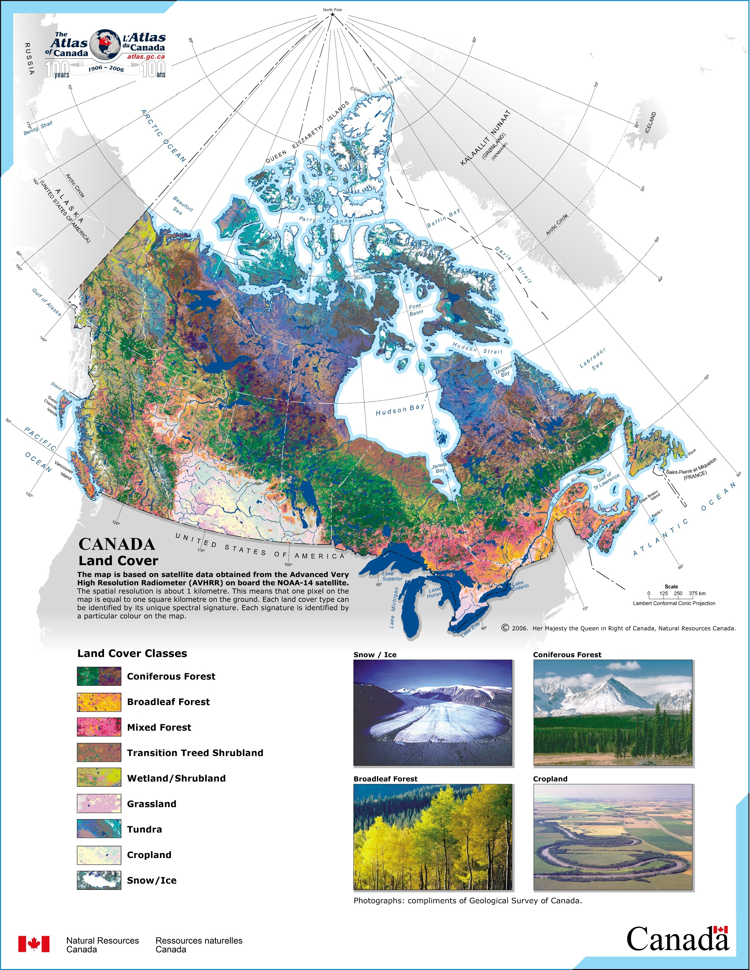
This map is a classic map presenting the spatial relationships of this environs with a basic assortment of elements.
You are allowed to download the map file and utilize it in your research. Giving credit to this webpage is always appreciated. Thank you kindly.
In the case that you want help acquiring a map, a specific map, or want a good custom product, please do not hesitate to contact our map specialists.
Purchase great customized maps from us. Custom maps made by YellowMaps consist of a full variety of elements, for example: highways, scale bar, UTM coordinates, bays, military area, towns, hamlets, or rapids, etc. Map types reach from topo to city, static to dynamic, county level to zip code.
Good maps are precise, up to date, and not deceptive. Detail-Oriented map design by YellowMaps.
To purchase printed maps or charts, like backroad mapbooks, state maps, or topo maps, I suggest you dive into our map shop We carry thousands and thousands map items.
Maps are just so interesting.
Back to Canada map collection